Topografía de precisión para tus proyectos

Transformamos tus ideas en planos con exactitud milimétrica.

Mediciónes de fincas

Mediciones de parcelas y fincas para determinar sus medidas, también sus perímetros georreferenciados.

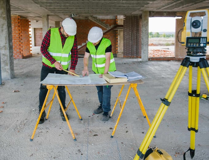
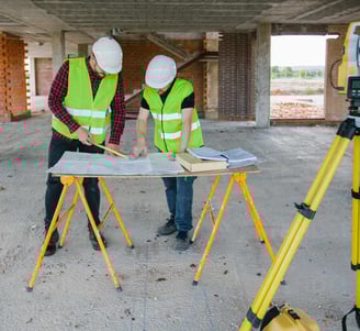
Topografía de edificación para tus necesidades.

Levantamientos de precisión para planos As-built.

Topografía de obras
Estados actuales de edificación

Expertos en topografía de precisión

En Costa Topografía, transformamos proyectos en realidad con precisión milimétrica, ofreciendo servicios especializados en planos topográficos y topografía de edificación.

150+

+1000

Clientes satisfechos

Proyectos exitosos

Servicios de Topografía

Ofrecemos topografía de precisión para proyectos con exactitud de hasta 1 mm.

ReplanteosTopográficos
A close-up of a surveying instrument, specifically a total station, mounted on a tripod. The instrument features an orange cylindrical target with a reflective surface and a black and yellow square backing with a cross pattern. The background is blurred, showing some cars and trees, suggesting an outdoor setting.

Realizamos replanteos de precisión con precisión milimétrica.

A metal topographical indicator displaying various landmarks, distances, and heights is prominently in focus. The background reveals an out-of-focus rocky terrain and a blurred figure of a person, suggesting an outdoor, elevated setting.
A tripod-mounted surveying instrument is prominently placed in the foreground, with a large construction site visible in the background. Tall cranes and unfinished buildings indicate ongoing construction work, set against a clear blue sky.
Georreferenciaciónes

Localización georreferenciada de levantamientos topográficos y elementos de proyecto.

Realizamos levantamientos topográficos con tecnología avanzada para asegurar resultados exactos.

Levantamientos Topográficos

Proyectos Topográficos

Realizamos proyectos de topografía de precisión con alta calidad.

A surveying instrument mounted on a tall pole stands in the foreground, with a bright blue sky and scattered clouds above. In the background, there are several modern high-rise buildings, indicating an urban area.
Edificación Precisa

Transformamos tus ideas en planos detallados con precisión milimétrica.

A person wearing a white hard hat and high-visibility vest operates a surveying instrument, focusing intently on the task at hand. The background is blurred with hints of other construction activities or team members.
Curvas de Nivel y Movimientos de tierra.

Creamos planos topográficos con curvas de nivel exactas para tus proyectos también ofreciendo cubicaciones de precisión con alto numero de puntos del terreno.

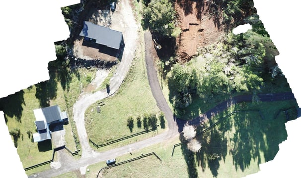
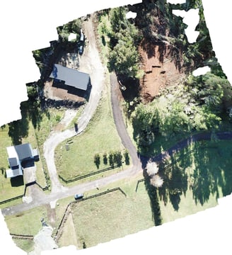
Fotogrametría y tecnología Drone

Realizamos fotogrametría de alta calidad de los proyectos para su mejor estudio tanto videos y fotografías.

El servicio de Costa Topografía es excepcional. La precisión en los planos topográficos es impresionante, logrando detalles que superan nuestras expectativas. ¡Altamente recomendados!

Alvaro Arriagada,Arquitecto

Hands are holding a topographic map and a compass. One hand is pointing at a specific location on the map, indicating navigation or orientation. The map is detailed with green shades, representing terrain or elevation.

★★★★★